


Enoree First Baptist Voting District, Spartanburg County, South Carolina
About
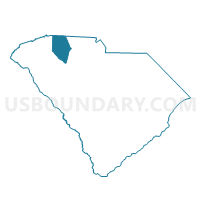
Outline

Summary
| Unique Area Identifier | 666756 |
| Name | Enoree First Baptist Voting District |
| County | Spartanburg County |
| State | South Carolina |
| Area (square miles) | 29.48 |
| Land Area (square miles) | 29.25 |
| Water Area (square miles) | 0.23 |
| % of Land Area | 99.23 |
| % of Water Area | 0.77 |
| Latitude of the Internal Point | 34.65484830 |
| Longtitude of the Internal Point | -81.93548250 |
Maps


Graphs
Select a template below for downloading or customizing gragh for Enoree First Baptist Voting District, Spartanburg County, South Carolina


Neighbors
Neighoring Voting District (by Name) Neighboring Voting District on the Map
- Cavins Hobbysville Voting District, Spartanburg County, SC
- Cross Anchor Fire Station Voting District, Spartanburg County, SC
- Cross Keys Voting District, Union County, SC
- Long Branch Voting District, Laurens County, SC
- Ora-Lanford Voting District, Laurens County, SC
- Woodruff Town Hall Voting District, Spartanburg County, SC
- Youngs Voting District, Laurens County, SC
Top 10 Neighboring County Subdivision (by Population) Neighboring County Subdivision on the Map
- Laurens CCD, Laurens County, SC (21,081)
- Gray Court CCD, Laurens County, SC (16,330)
- Clinton CCD, Laurens County, SC (14,740)
- Woodruff CCD, Spartanburg County, SC (10,919)
- Enoree CCD, Spartanburg County, SC (4,464)
- Cross Keys CCD, Union County, SC (1,244)
Top 10 Neighboring Place (by Population) Neighboring Place on the Map
Top 10 Neighboring Unified School District (by Population) Neighboring Unified School District on the Map
- Laurens School District 55, SC (37,250)
- Union County School District, SC (28,961)
- Laurens School District 56, SC (20,726)
- Spartanburg School District 4, SC (18,439)
Top 10 Neighboring State Legislative District Lower Chamber (by Population) Neighboring State Legislative District Lower Chamber on the Map
- State House District 35, SC (39,561)
- State House District 16, SC (32,736)
- State House District 42, SC (31,209)
- State House District 15, SC (30,253)
Top 10 Neighboring State Legislative District Upper Chamber (by Population) Neighboring State Legislative District Upper Chamber on the Map
Top 10 Neighboring 111th Congressional District (by Population) Neighboring 111th Congressional District on the Map
Top 10 Neighboring Census Tract (by Population) Neighboring Census Tract on the Map
- Census Tract 236, Spartanburg County, SC (6,010)
- Census Tract 235, Spartanburg County, SC (4,909)
- Census Tract 9206, Laurens County, SC (4,700)
- Census Tract 237, Spartanburg County, SC (4,464)
- Census Tract 307, Union County, SC (3,313)
- Census Tract 9205.01, Laurens County, SC (1,761)
- Census Tract 9201.02, Laurens County, SC (1,588)